Tag Archives: geography

University of Durham studies on Libya in the 1960s

In the late 1950s into the 1960s, the area of Durham, England became very involved in the development of the oil industry, including accompanying types of research, in Libya. The University of Durham’s geography department hosted a major geographic research project on Libya, and the county of Durham was involved in the construction of one of the earliest oil pipelines in Libya (the very first shipment of Libyan crude oil in 1961 actually went to a British refinery). This activity, funded by various parties interested in the exploration and mapping of Libya, produced over a dozen MA and PhD dissertations on various aspects of Libyan geography in the 1960s, as well as other publications. In fact, Durham’s Geography department hosted what may have been the very first crop of Libyan PhD students in a Western university.

Y.T. Toni1957A study of the Social Geography of Cyrenaica (PHD)
R.W. Hill1960Some problems of economic geography in northern Tripolitania: a study of agriculture and irrigation on the Jefara plain (PHD)
J.A.N. Brehony1961A geographical study of the Jebel Tarhuna, Tripolitania (PHD)
K.S. McLachlan1961A geographical study of the coastal zone between Homs and Misurata, Tripolitania: A geography of economic growth (PHD)
A.R. Taylor1961The Cultivation of the Olive in Tripolitania: Some aspects of agrarian geography (MLitt)
Hadi M. R. Bulugma1960
1964
The Western coastal zone of Tripolitania: A human geography (MLitt)
The Urban Geography of Benghazi (PHD)
Mukhtar M. Buru1960
1965
A geographical study of the Eastern Jebel Akhdar, Cyreniaca (MLitt)
El-Marj Plain: A Geographical Study (PHD)
Robert G. Hartley1968Recent population changes in Libya: economic relationships and geographical patterns (PHD)
Salem Hajjaji1969The land use patterns and rural settlement in the Benghazi plain (PHD)
Mahmud A. Khuga1960
1969
The Jebel Garian in Tripolitania: A regional study (MLitt)
The growth and functions of Tripoli, Libya (PHD)

The Department of Geography also published a handful of studies on Libya stemming from the same period of research activity, including much fieldwork on-site in Libya. (Click the links below for PDFs)

R.W. Hill, A Bibliography of Libya (Department of Geography, Research Papers Series No. 1, 1959). Durham.

S.G. Willimott & J.I. Clarke (eds.). Field Studies in Libya (Department of Geography, Research Papers Series No. 4, 1960). Durham.

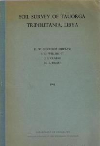
D.W. Gilchrist Shirlaw, S.G. Willimott, J.I Clarke, M.E. Frisby. Soil Survey of Tauorga Tripolitania, Libya (Department of Geography, 1961). Durham

G.H. Blake. Misurata: A Market Town in Tripolitania (Department of Geography, Research Papers Series No. 9, 1968). Durham.

Thesis: Insurgent Geographies: The Production of Territorial Libya, 1835–1935

Lohnes, Jonathan M. 2022. Insurgent Geographies: The Production of Territorial Libya, 1835–1935. PhD Dissertation, Cornell University. (open access)

Abstract: This dissertation offers a panoramic reinterpretation of Libyan state-formation in light of Ottoman archival evidence and recent advances in critical geography, particularly revisionist approaches to the history of territory. Echoing Henri Lefebvre’s description of space as the “ultimate locus and medium of struggle,” I argue that the dynamic, frequently violent interaction of a diverse cast of networked social forces—local, transregional, Ottoman imperial, and European colonial— across a vast Saharan-Mediterranean theater produced the entity we now recognize as territorial Libya from approximately 1835 to 1935. Territorial spatialization along the rural frontiers of Tripolitania, Cyrenaica, and Fezzan is not reducible in theory to the enclosure of land or conquest of terrain— though both featured prominently within it—but also encompassed legal, diplomatic, technical-scientific, and ideological dimensions. The process unfolded in two phases: Ottoman provincialization, which transformed these areas into a “pilot province” for Istanbul’s ambitious development agenda, and Italian fascist colonization, which unified the country in the form of a colonial state after a twenty-year “pacification” campaign. Both phases unfolded at the expense of rural indigenous communities, who were targeted for disarmament, dispossession, displacement, and culminating in the ethnic cleansing of Cyrenaica in the late 1920s and early 1930s. Indigenous efforts to preserve local understandings of sovereign autonomy—up to and including “nomadic strategies” of guerrilla war—were the most historically and geographically significant factor in the production of Libyan territorial space. Modern Libya’s unique experience of territorial spatialization dislocated the country from the conceptual maps that guide us through transnational, regional, and local pathways of Global South history. Its ambivalent and fragmentary “geo-historical identity”—exemplified by the fact that Fezzan remains synonymous with “the middle of nowhere” in modern Turkish—is among the most enduring legacies of this process. Yet this inherited sense of Libya’s rural interior as the Periphery of Peripheries belies the fact that upland Tripolitania, Fezzan, and inner Cyrenaica often took center stage in the high drama of late and post-Ottoman politics. More than a microcosm of transformations underway across the Empire in its final century, this region was a critical frontline of global struggles over resources, sovereign legitimacy, geographic knowledge, and the fate of mobile and nomadic populations. All of which is to say, the middle of nowhere is the heart of the world.

Article: The Life Cycle of the Libyan Coastal Highway

Distretti, Emilio. 2021. The Life Cycle of the Libyan Coastal Highway: Italian Colonialism, Coloniality, and the Future of Reparative Justice in the Mediterranean. Antipode: A Radical Journal of Geography 53(5). 1421–1441.

Abstract: This paper explores the role of the Libyan Coastal Highway across history: originally built by fascist Italy during colonisation, in the postcolonial era Libya demanded Italy commit to the construction of a new motorway as part of the reparation process for its crimes. Only in 2008 was an agreement reached. Through it, Italy used the promise to build a new road as a bargaining-chip to secure Qaddafi’s cooperation in containing migrant mobility across the Mediterranean. This paper explores the different ways in which the Libyan road has endured as a space and a tool of power by tracing historical and political continuities across time, from colonisation to demands for postcolonial reparations and migration governance. Drawing inspiration from the notion of “coloniality”, the paper investigates the colonial continuum expressed by the Italian/Libyan reparation process, and seeks to posit alternative pathways towards the unresolved question of postcolonial justice around the Mediterranean.

Book: Desert Borderland

Matthew Ellis, Desert Borderland: The making of modern Egypt and Libya, Stanford University Press (coming 2018).

Publisher’s blurb: “Desert Borderland investigates the historical processes that transformed political identity in the easternmost reaches of the Sahara Desert in the half century before World War I. Adopting a view from the margins—illuminating the little-known history of the Egyptian-Libyan borderland—the book challenges prevailing notions of how Egypt and Libya were constituted as modern territorial nation-states.

Matthew H. Ellis draws on a wide array of archival sources to reconstruct the multiple layers and meanings of territoriality in this desert borderland. Throughout the decades, a heightened awareness of the existence of distinctive Egyptian and Ottoman Libyan territorial spheres began to develop despite any clear-cut boundary markers or cartographic evidence. National territoriality was not simply imposed on Egypt’s western—or Ottoman Libya’s eastern—domains by centralizing state power. Rather, it developed only through a complex and multilayered process of negotiation with local groups motivated by their own local conceptions of space, sovereignty, and political belonging. By the early twentieth century, distinctive “Egyptian” and “Libyan” territorial domains emerged—what would ultimately become the modern nation-states of Egypt and Libya.”

Article: Claiming the Libyan Space

Jakob Krais, “Claiming the Libyan Space: Fascist lieux de memoire in North Africa” in Mediterráneos: An Interdisciplinary Approach to the Cultures of the Mediterranean Sea, ed. Martin et al., Cambridge (2013), pp. 275–290.

Abstract: During their rather short colonial rule over Libya (1911-1943) the Italians tried to appropriate the territory of the North African country not only militarily administratively, but also symbolically. To achieve this, the government, especially the Fascist regime in the 1920s and 30s, attempted the creation of places of memory (I here use the the term lieux de mémoire, following Nora) on the colony’s soil that was to incorporated into Italy as its so-called Fourth Shore. The means used were archaeology, linking modern colonization to the ancient Roman Empire, architecture that was to immortalize Italian rule for the future, and Mussolini’s 1937 visit as a reference point for a new Mediterranean empire.

The article is available to download at the above link.

Book: Organization and Social Structure in Libyan Oases

ghadames-chart-eldblom1968

Organization of cultivated land in Ghadames (pull-out chart from Eldblom, Structure foncière, 1968).

In the late 60s, the Swedish scholar Lars Eldblom published an extremely detailed study of the socio-economic life in the three Libyan oases of Ghadames, Ghat, and Mourzouk. Since life in Libya has changed dramatically since then, his work undoubtedly documents pheno-mena of oasis life that hardly or no longer exist. It is also full of detailed maps and figures, based on painstaking research. Because of its high level of detail it certainly deserves to be better known. The book is:

Eldblom, Lars. 1968. Structure foncière. Organisation et structure sociale. Une étude comparative sur la vie socio-économique dans les trois oasis libyennes de Ghat, Mourzouk et particulièrement Ghadamès. Lund.

He also published an English summary of the book, under the following title (available freely online):

Eldblom, Lars. 1971. Land tenure – social organization and structure: a comparative sample study of the socio-economic life in the three Libyan oases of Ghat, Mourzouk and Ghadamès. Uppsala University: Nordic Africa Institute.

And finally, I have also found an earlier study of his focusing especially on irrigation in the oases of Brak, Ghadames, and Mourzouk:

Eldblom, Lars. 1961. Quelques points du vue comparatifs sur les problèmes d’irrigation dans les trois oasis Libyennes de Brâk, Ghadames et particulièrement Mourzouk. Lund (Lund Studies in Geography 22).

Book: Benghazi Through the Ages | بنغازي عبر التاريخ

The Libyan historian Hadi Bulugma produced a series of books in Arabic on the history of Benghazi entitled بنغازي عبر التاريخ. He also made an abbreviated English version, the first volume of which (I am not sure that the second and third volumes were ever finished) concentrates on the geography and geographical history of the city. Here is a PDF of the book.

Bulugma, Hadi. 1968. Benghazi through the Ages. Volume I. Dar Maktabat al-Fikr, Tripoli.